“Greater Muskoka”
July 14, 2021
 |
|
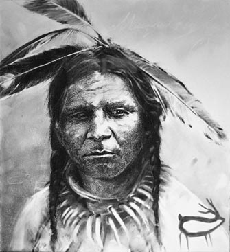
This likeness of Chief Musquakie, for whom Muskoka is named, has been rendered by artist Bonnie Bews, who drew on historical records describing his appearance. |
Which brings us squarely back to the nature of Muskoka’s boundary lines. Looking at a map, those natural Georgian Bay and Severn River water boundaries are unmistakably clear. However, the land lines for Muskoka’s north and east appear artificial – because they are. Between the era of First Nations and trappers quietly enjoying Muskoka and the invasion of settlers with vacationers soon following on their heels, provincial surveyors imposed those boundary lines for the sake of dividing a vast territory into smaller jurisdictions for administrative convenience of those who would have to govern Muskoka, once the provincial government “opened up” the land for logging and farming.
On the ground itself, though, Nature was unchanged. The contiguous Canadian Shield landscape, then as now, just keeps on rolling out. Whether you fly above it, drive through it, or paddle across it, this region north and east of Muskoka all looks and feels pretty much the same – because it is.
This larger region, stretching from Lake Huron’s Georgian Bay over to the Ottawa River was, for a long time, known as the Huron-Ottawa Tract – a geographically integrated zone, with Muskoka and Parry Sound anchoring its western side along Georgian Bay. Then, a century ago, this zone came to be known as “the Ontario Highlands,” for tourism appeal. Railway companies and tourist organizations publicized the extensive elevated area as a single large plateau of Canadian Shield lakeland, great for fishing, breathing pure air, and savouring close harmony with primal nature. Today, the same area is dubbed “the Near North” by some. Only the name changes; the land itself is the same.
 |
|
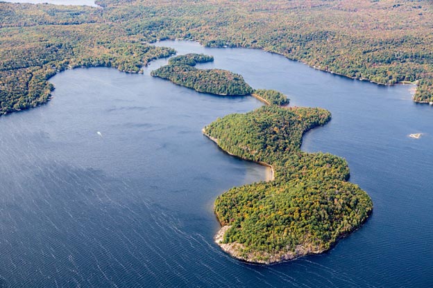
Langmaid’s Island in Lake of Bays was severed, legally but not in reality, by surveyors who originally placed it in two different townships when laying out Muskoka’s “grid.” |
The point is that regardless of names, and apart from the District’s legally established boundaries, Muskoka is naturally much greater in extent.
So to accurately answer the question “How Big is Muskoka?” we need to stop fixating on the mapped District as it was surveyed, divided, and organized for provincial and municipal government purposes in the 1800s. To see Greater Muskoka only requires looking at this through a different lens.
The land we see today has only been this way for the past ten thousand years. That’s ten thousand of the 4 to 5 billion years that planet Earth has been forming. This recent era is not about the truly grandiose geological and climatic change story about shifting continental plates, volcanoes, earthquakes, mountain ranges being cast up and then worn down to Muskoka’s present gneiss bedrock outcroppings of Earth’s oldest rock, or the prior four Ice Ages. The last ten millenniums since the most recent Ice Age retreated contained enough events of their own to make a huge impact of Muskoka and the larger territory of which it is a part.
The intense weight of those ice sheets, rising some 2 to 3 miles above present-day Muskoka, pushed the land mass way down, almost to sea level. That meant, when the ice melted, that the whole region was one gigantic lake, known to geologists as Lake Algonquin, from which today’s Georgian Bay, Lake Huron, and Lake Michigan all emerged once the land rebounded upward and water levels fell. About five thousand years ago, so now really quite recently, the water level and land mass reached their general equilibrium familiar to us today, although for a while longer, the eastern shore of Georgian Bay was still further inland, about where Highway 11 now runs through Muskoka.
 |
|
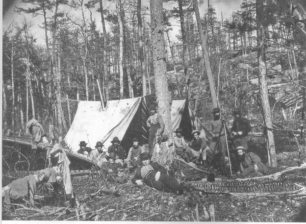
This survey crew faced arduous conditions laying straight lines through Muskoka and Parry Sound sections of Canadian Shield landscape. |
Advancing in time a few more millenniums, Indigenous peoples inherited this landscape, once it could again sustain life by supporting vegetation and animal habitats, about 6,000 years ago. We’ll pick up that fascinating saga, because it is a prime factor in just “how big” Muskoka is, in a bit.
But first, as you can tell from those dates, it was only recently –meaning during the past 150 years – that Muskoka District acquired political form. By the 1840s trappers were referring to the area as “Muskoka,” a name that appeared on maps relating to its First Nation occupants by that date. Two decades later, in the 1860s, the provincial government created the Territorial District of Muskoka by enacting a statute. The woods and waters remained unaltered by such human procedures in the distant provincial capital. A more direct effort by government surveyors plotting straight lines through Muskoka’s rugged terrain was necessary. They stubbornly prevailed, over several decades, imposing a geometric grid on much but not all of the land, marking out the townships, concession lines, road allowances, and property lots.
Next came settlers, slower than the government wanted, so in 1868 another enactment provided the incentive of getting land in Muskoka for free. By 1876, the District’s boundaries were formally defined by yet another statute. Then several generations of settlers, and successive families of seasonal vacationers as well, all came to understand Muskoka as this precisely defined section of Ontario’s landscape. As already noted, those boundaries were Georgian Bay on the west, the Severn River at the South, Parry Sound to the north, and at the east abutting Haliburton.
This specific version of Muskoka District took hold as a distinct concept. It became an organizing framework within which both permanent and part-time Muskokans conducted their social, political, economic, and cultural lives. It offered a unified identity for several generations.
However, despite Muskoka’s enduring geological nature and physical geographic attributes, the current governmental reality makes that map of Muskoka District just about the most misleading document in existence. It has become a time-trapped snapshot. It is not an accurate image of Muskoka’s size and nature.
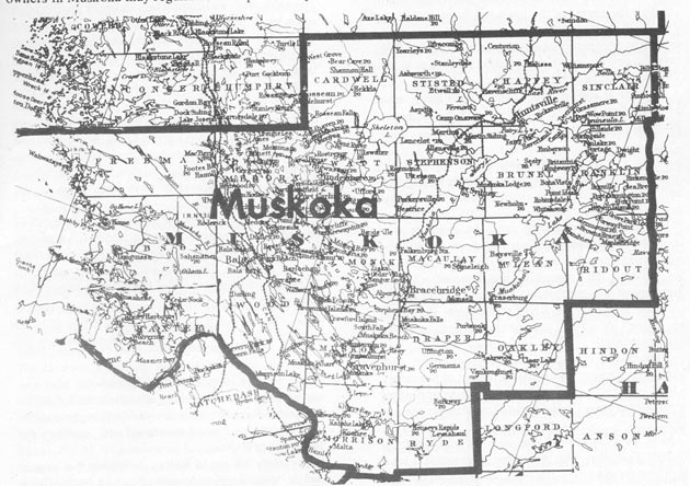 |
| This map shows Muskoka’s 22 original townships in their tight 1800s rectangular grid formation which, from above, still resembles the District’s “official” boundaries today. |
Seen from above, Muskoka still looks the same today: Georgian Bay’s rocky shoreline and islands define our District’s westerly limits; the Severn River cuts a clear southern boundary; the original surveyor’s line through rocky forests and wetlands for the Bobcaygeon Road maps our “mysterious east” border; another surveyor’s line, running between Muskoka and Parry Sound districts, demarks our contiguous territories. Unifying all is the life-giving Muskoka watershed, source of our district’s appeal.
Seen from the side, however, a cross-section shows Muskoka District sliced into bits and pieces by someone from the Mad Hatter’s Tea Party.
Just a few years ago, when most of Muskoka’s independent weekly newspapers were bought up by the Toronto Star organization, their new Toronto owners blended these once-distinctive papers into an overall publication called MuskokaRegion.com. That was an objectionable name to those seeking to maintain Muskoka’s identity as a District, but it was simultaneously a dose of realism by acknowledging that, if anything, the District’s boundaries had become so porous that “region” was more accurate for Muskoka than its circumscribed geographic status as a “district” of Northern Ontario.
Back in the 1800s Muskoka had taken legal shape in several stages, with different enactments by the legislature: as a provisional district, then a municipal district, then in very uneven steps townships, villages, and towns with enough people became municipalities themselves. In 1970 another enactment revamped the District’s internal government structures, leaving a District Municipality with divided jurisdictions between one overall government and six sub-municipalities. Now a half-century under this arrangement has been time enough for another couple generations to live, work, and habituate to the idea that Muskoka District is still the same place it looked like on the map ever since the mid-1800s.
But it is not. It has changed in two ways. First, all that was distinctive about Muskoka has been obliterated by the province. The District Municipality of Muskoka Act was repealed in 2003, our 1970 municipal structures becoming subsumed under general Municipal statutes. Our distinctiveness was eroded further by the provincial government removing all Muskoka’s “Northern benefits” to which Ontario’s districts are entitled. A dozen other ways that local control has been forfeited, and Muskoka’s distinctiveness obliterated by provincial actions, will be the subject of a more detailed blog.
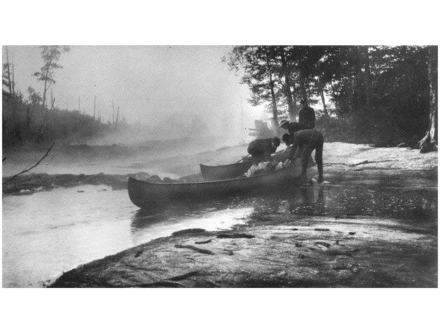 |
| Canoeing from Lake Muskoka down the Moon River to Georgian Bay, early Euro-Canadians thrilled to their primal encounter with Nature, despite the spoiler effects of clear-cut logging which began to “open up” the District in the 1850s. |
The second change has made Muskoka much bigger. Even from the District’s inception, Muskoka was linked with adjacent Parry Sound as a provisional judicial district for the administration of Justice. For political representation, the District’s electoral boundaries made it part of counties to the south. Initially, land transactions were administered from Victoria and Simcoe county registry offices, and municipal government run as part of them as well.
There was a period, though mid-20th century, when the District of Muskoka really came into its own, pretty much a free-standing entity in terms of identity and local government. However, that historic high-water mark has since been steadily eroded by successive waves of policies developed and programs introduced by senior Ontario civil servants with inimical ideas about social cohesion and community integrities. Their plans were steadily implemented by legislators who no longer have an independent perspective and the political stamina to withstand this inexorable rise of Ontario’s administrative state.
In the result, Muskoka District has been incrementally joined up with surrounding jurisdictions. For electoral representation in the House of Commons and Ontario’s Legislature, Muskoka, once paired with counties to the south, is now joined with the district to the north. For administration of justice, Muskoka District always paired with Parry Sound, as noted, more recently became joined with sections of Simcoe County as well. Muskoka schools and educational systems were meshed in 1998 with those of Victoria County and Haliburton County to our east, operating under the common Trillium Lakeland Board of Education. Medical and health services in Muskoka are generally now northern extensions of Simcoe County systems, operating under the Simcoe Muskoka Health Unit, yet Muskokans are simultaneously connected to Haliburton for some medical health matters under Muskoka Algonquin Health Care. For social and family services, Muskoka is partnered with Simcoe. When it comes to economic measures, Muskoka is now fragmented all over the broader map – part of the North for Ottawa’s FedNor economic development purposes in Northern Ontario, but no longer part of the North for the provincial government’s grants to districts, and excluded by Ontario from other Northern benefits as well.
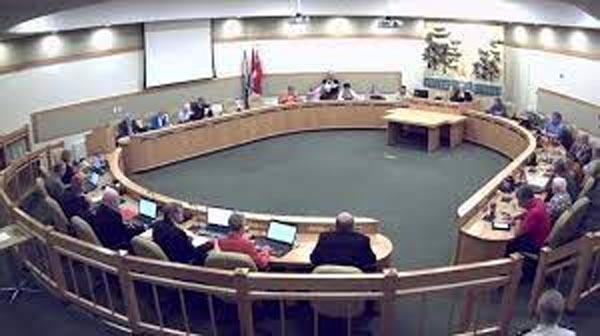 |
| District of Muskoka Council, since 1971 has increasingly contended with split jurisdictions that see Muskokans operating for diverse provincial programs in four surrounding entities, the District of Parry Sound and Haliburton, Victoria, and Simcoe counties. |
In addition to how government services and programs scatter Muskokans in all directions, some tourist organizations lump the District into their “Central Ontario” region while others promote Muskoka as part of the “Near North.” Neighbourhood Watch crime busters even link “Muskoka-Simcoe-Durham” as an unusual geographic entity that puts the District into the Greater Toronto Area.
This advancing pattern complicates life for Muskokans trying to sort out which jurisdiction they are really in. So many layers of government operations today are organized according to different institutional structures and oddly aligned geographic boundaries that people are now hired to help citizens navigate their interface with the confusing and often conflicting dimensions of their own government in the modern Ontario state.
From the perspective of the 50 or so municipal elected representatives in Muskoka District, this fragmented, expanded, and geographically inconsistent arena is particularly confounding. Councillors, trustees, and municipal staff must constantly deal with different sets of civil servants and engage in separate political forums in the routine course of addressing health, justice, community services, social services, environmental issues, education, and political affairs. At Casino Rama, it is easier to get all the slot-machine cherries or bananas into alignment. Control over District affairs has effectively passed out of the hands of Muskokans.
 |
| Simcoe county medical-centered programs now drive operations in Muskoka. As good as they are, the result is Muskoka’s lateral fragmentation, contributing to “Greater Muskoka.” |
As messy and confusing as this is, standing back for a clear and dispassionate view of present circumstances shows how, in a bizarre way, the District has been significantly enlarged by this extension of governmental operations outside its borders.
But other dimensions of “Greater Muskoka” are far more positive. Following blogs will look at how Indigenous Heritage, the “Muskoka Mystique,” and the Digital District each make Muskoka far greater than the District’s formally measured 1876 size.